
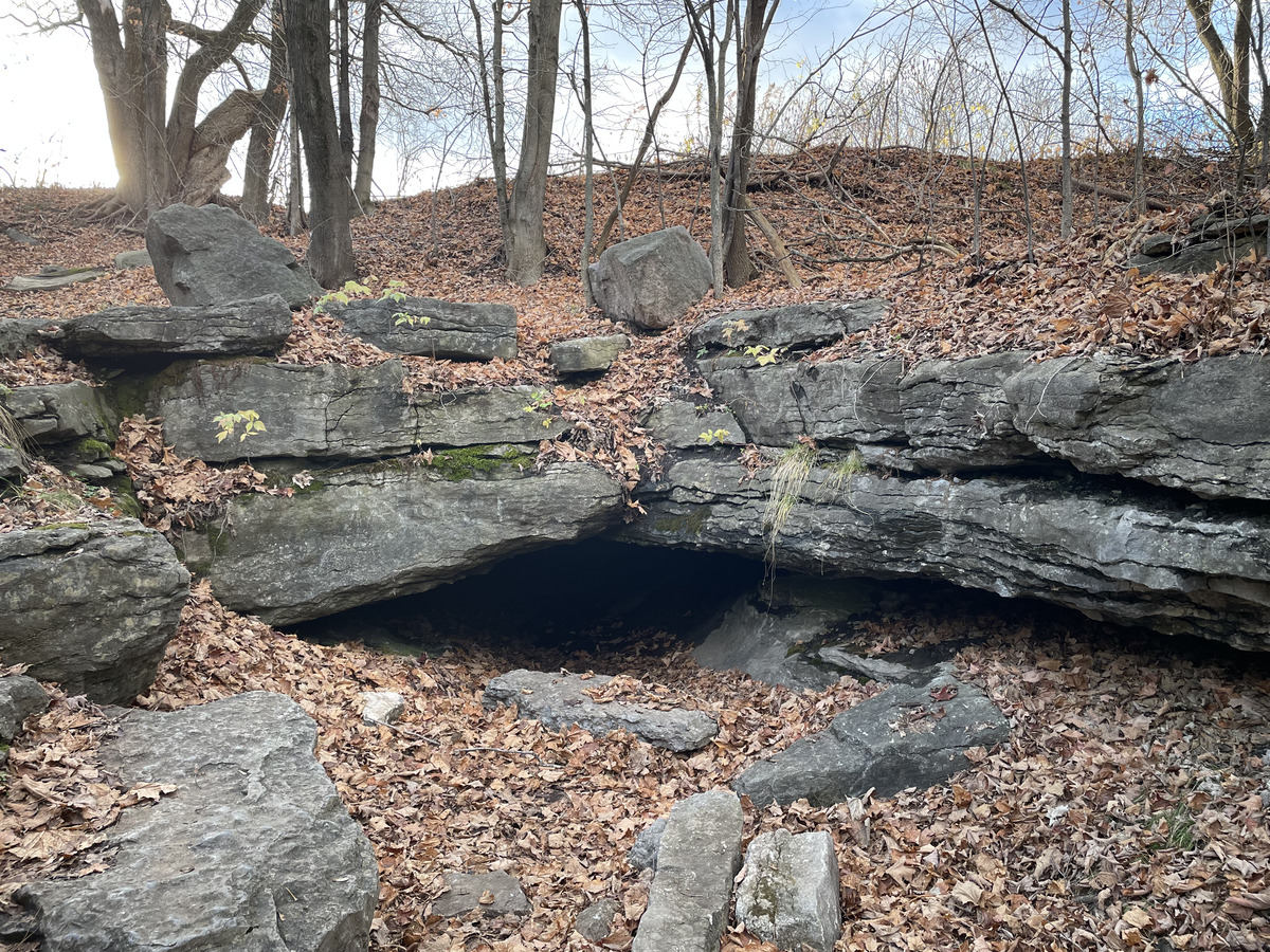
A cave by the river!
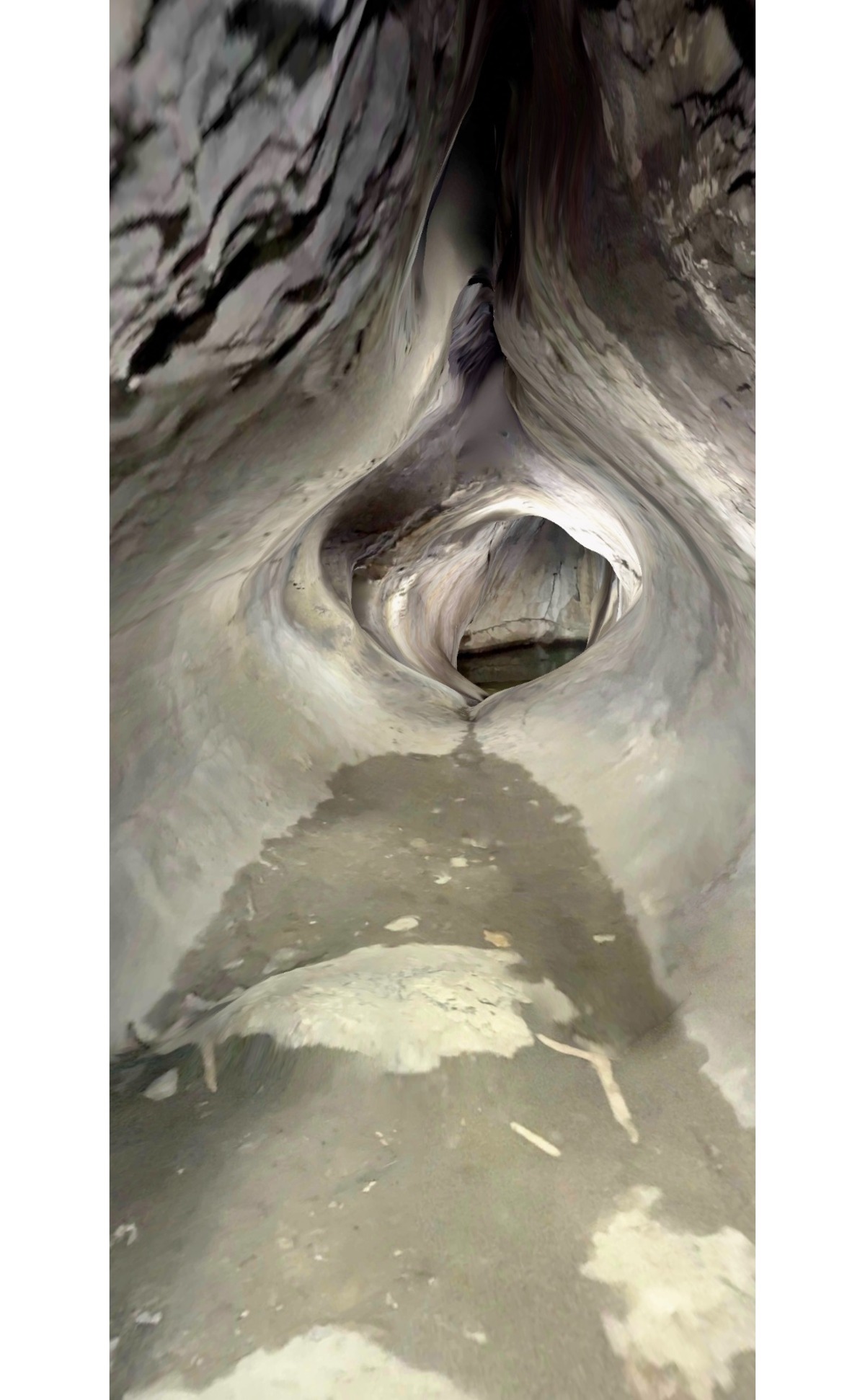
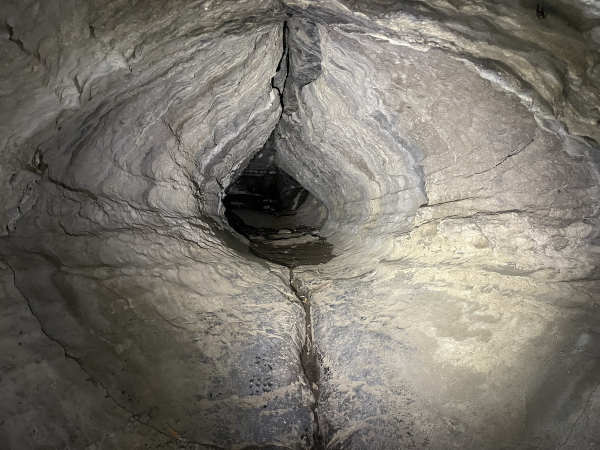
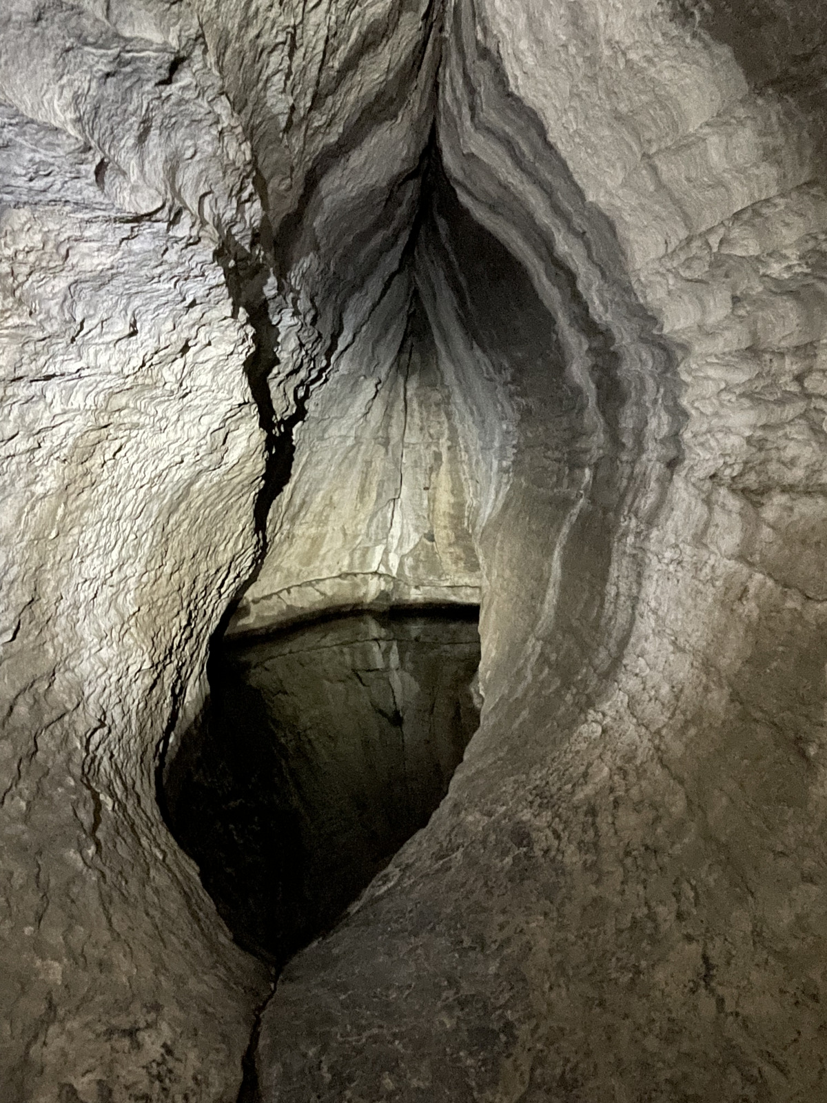
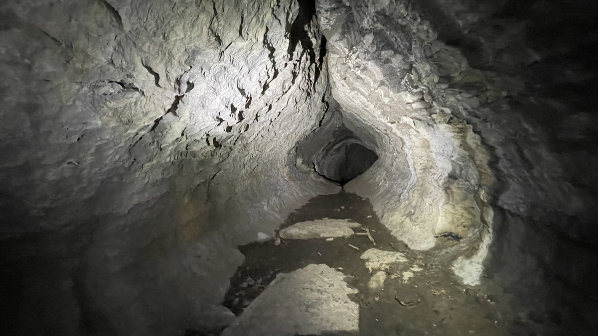
Very nicely shaped tunnel.
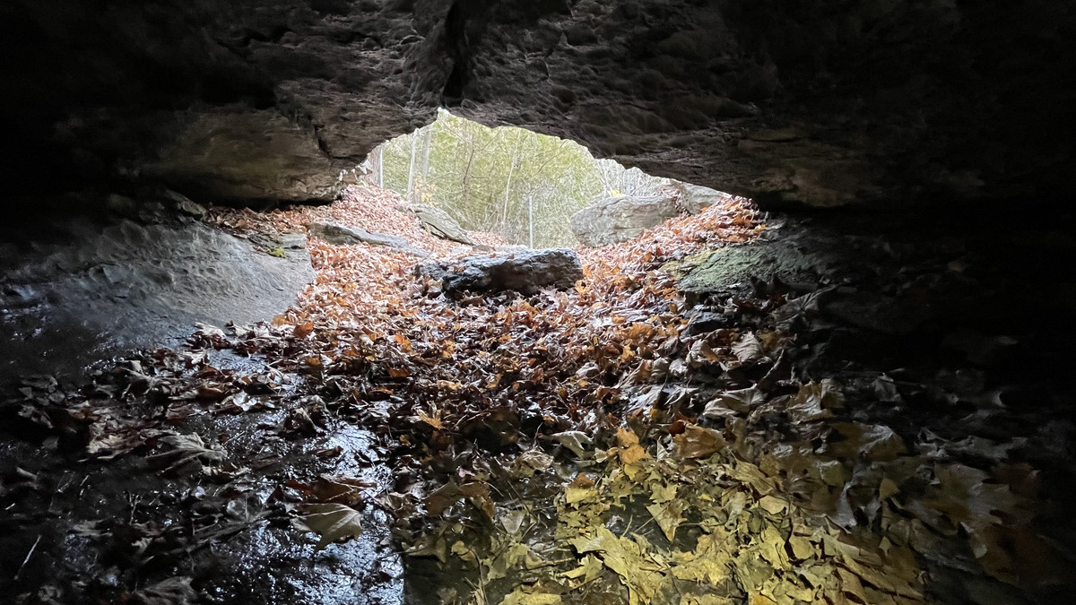
There are two entrances, the main, low entrance from the river bank rock, and another straight-down entrance from the top.
The cave is long, 126 meters, but the easily accessible part is just 24 meters, the rest is tight and may also be blocked by water unless it is dry season.
Here's the 3D scan-based map (of the part that is accessible, the cave continues further):
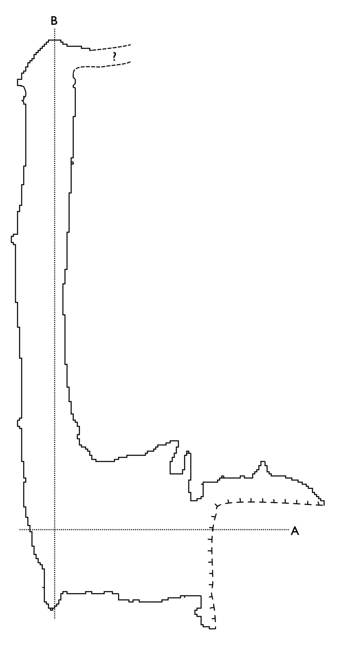
A high resolution version of the map is here. The model itself can be accessed here in GLB and Blender formats, you can also rotate it yourself on your browser screen.
The official map from the place itself has a more complete map:

My model looks like this:
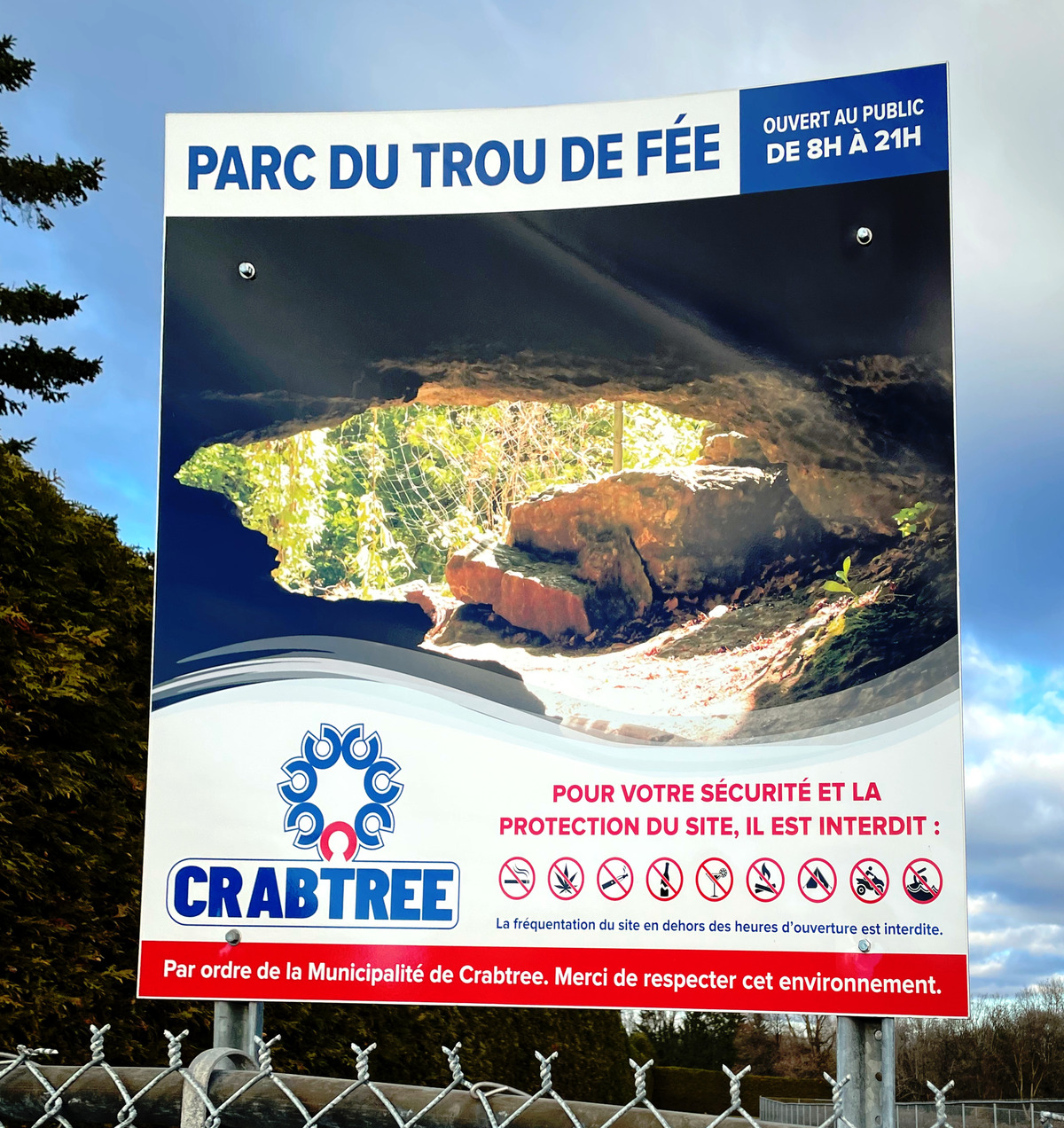
The cave is open 9-21 during the tourist season. There's ample parking and an overall nice environment.
The entrance:
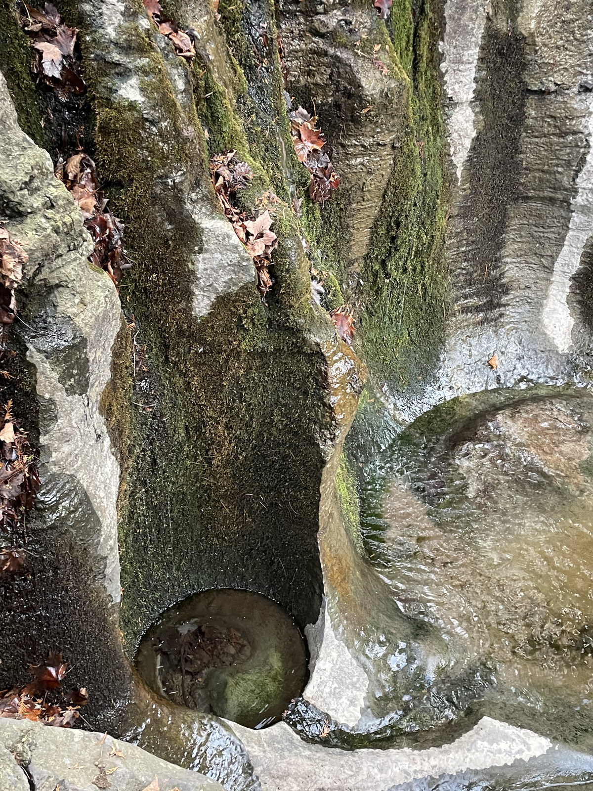
More pictures from the nice tunnels:
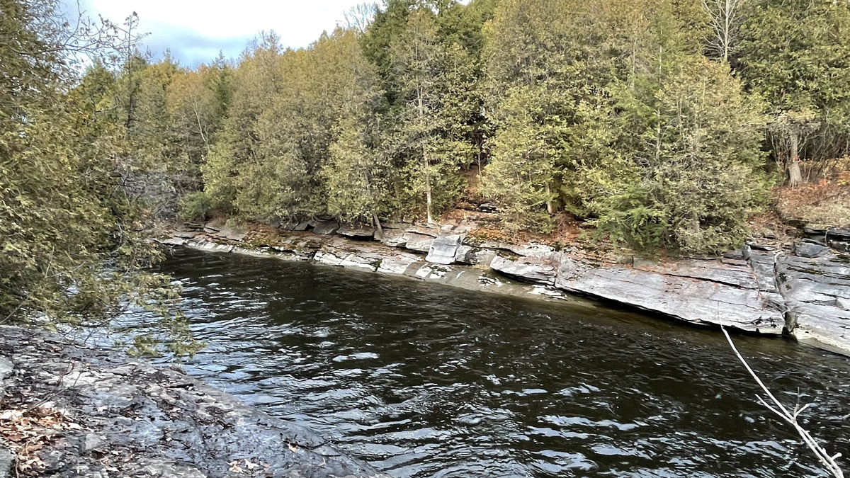
The cave is by this river:
For more information about the cave and access, try these web sites: Tourism Joliette, Crabtree. I visited the cave in (late) summer 2024.
This article has also been published at Planetcaver.net here. Read the full Planetskier series at planetskier.net, urban exploration stories from theurbanexplorer.net, and other underground stories from planetcaver.net, or all blog articles from Blogspot, TGR. Photos and text (c) 2024 by Jari Arkko. All rights reserved.
This article was originally published in the Planetskier Blogspot article series.
"Mongolia is kind of close, right? Story about an attempt to ski everywhere in the world where there's snow. And in some places where there isn't. On and off-piste skiing on all continents, skiing into craters of live volcanoes, climbing, photography, and travel." The Planetskier blog focuses on skiing, caving, climbing, biking, flying, sauna, and swimming adventures around the world. See the other Planetskier blog articles about skiing, caving, urban exploration, climbing, cycling, flying, swimming, and saunas.